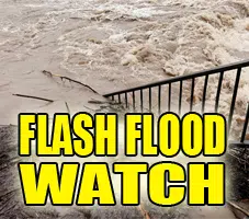
FLASH FLOOD WATCH IN EFFECT FROM MIDNIGHT CDT TONIGHT THROUGH SUNDAY MORNING including:
Logan-De Witt-Piatt-Champaign-Vermilion-Cass-Menard-Scott-Morgan-Sangamon-Christian-Macon-Moultrie-Douglas-Coles-Edgar-Shelby-Cumberland-Clark-Effingham-Jasper-Crawford-Clay-Richland and Lawrence counties
Heavy rain and flash flooding possible for most of central, eastern and southeast Illinois from the remains over Tropical Storm Gordon…
The National Weather Service in Lincoln has issued a Flash Flood Watch for portions of central Illinois, east central Illinois, southeast Illinois, and west central Illinois, including the following areas, in central Illinois, Christian, De Witt, Logan, Macon, Menard, Piatt, Sangamon, and Shelby. In east central Illinois, Champaign, Clark, Coles,
Cumberland, Douglas, Edgar, Moultrie, and Vermilion. In southeast Illinois, Clay, Crawford, Effingham, Jasper, Lawrence, and Richland. In west central Illinois, Cass,
Morgan, and Scott.
* From midnight CDT tonight through Sunday morning
* Periods of heavy rain are expected to develop late tonight, and continue to develop Friday, through Saturday night.
The rainfall will develop in response to the remains of Tropical Storm Gordon moving over southern Illinois, and combining with an old frontal boundary that is stalled over
the area. Heavy rainfall amounts of 4 to 6 inches will be possible in some areas.
* The additional heavy rain will combine to make flash flooding possible, especially in flood prone and other low lying areas.
PRECAUTIONARY/PREPAREDNESS ACTIONS…
A Flash Flood Watch means that conditions may develop that lead to flash flooding. Flash flooding is a VERY DANGEROUS SITUATION.
You should monitor later forecasts and be prepared to take action should Flash Flood Warnings be issued.


